Doodoos In the Hoodoos?

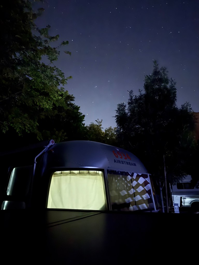
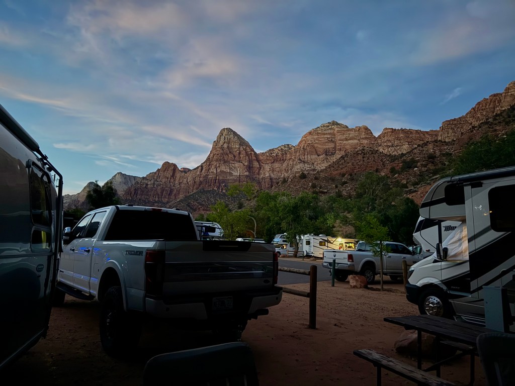
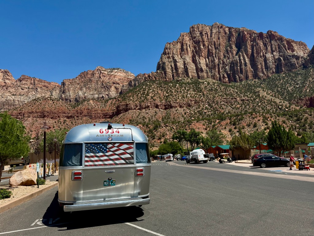
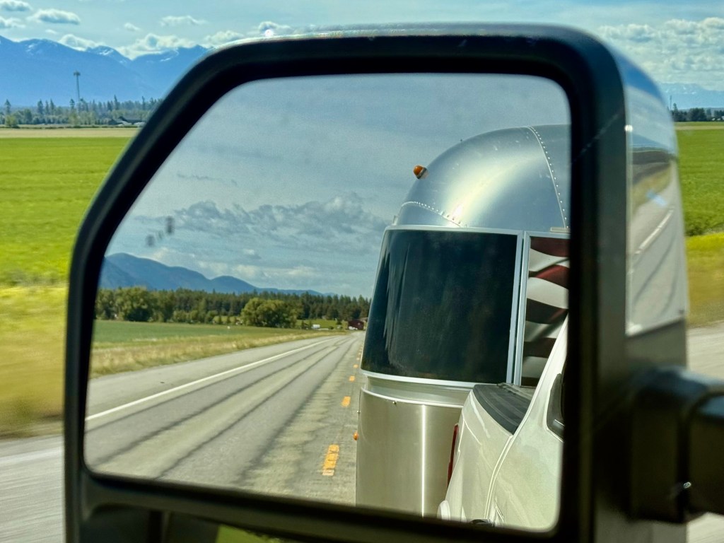
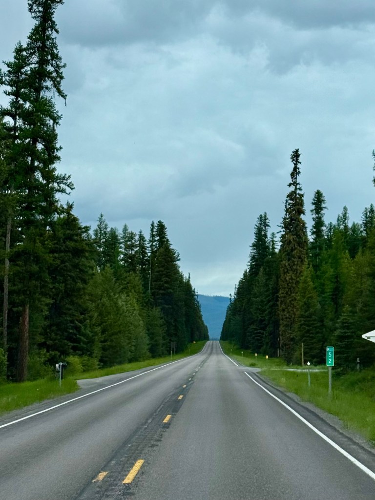
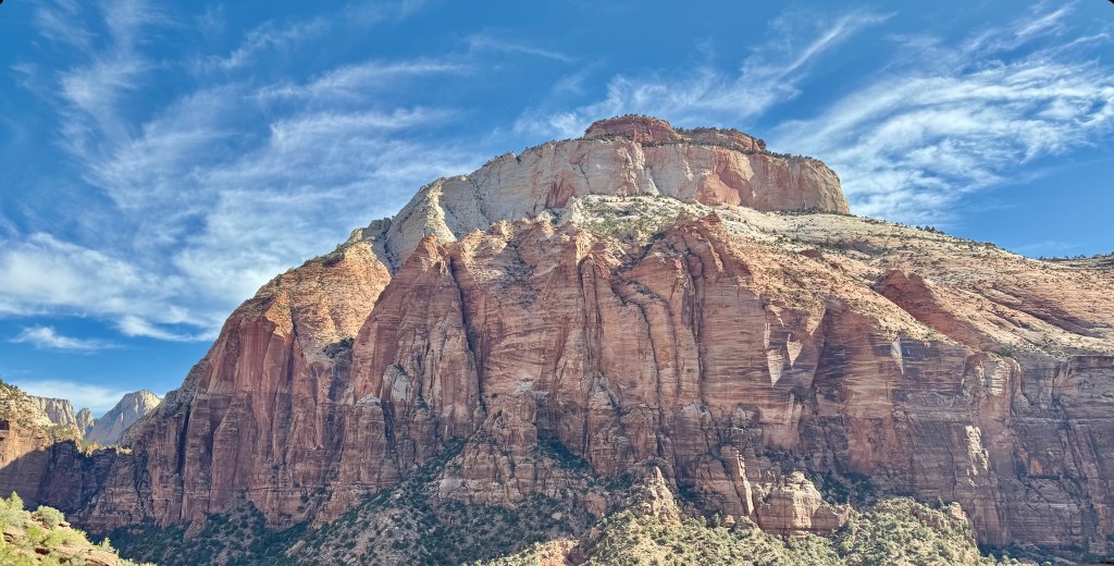
We decided to take the very scenic, two hour drive from Zion to Bryce Canyon National Park today to see what we missed in 2023, when we motored through. Plus, our cousin Nancy said it was one of her favorite parks and we’re pretty close! So, we loaded up the hiking stuff, made sure the airstream was locked up and doing its best to stay cool behind us, and we set off at the bright and early crack of 9:30 for Bryce!

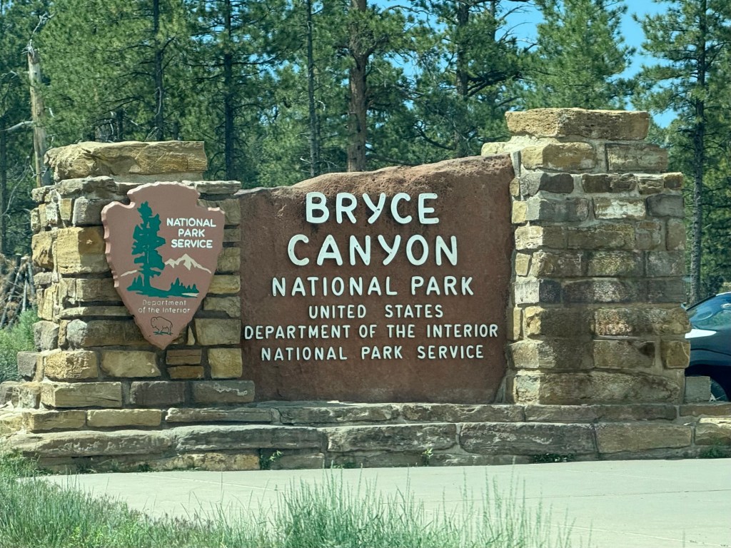
Made it to Bryce and this time, we found a parking spot!

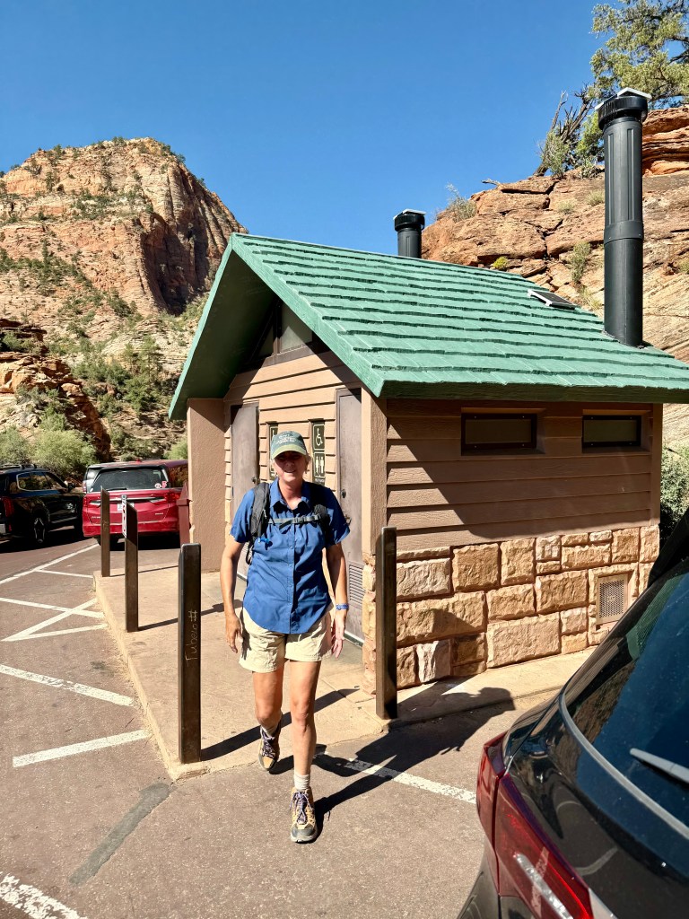
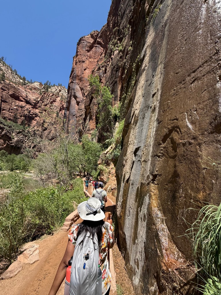
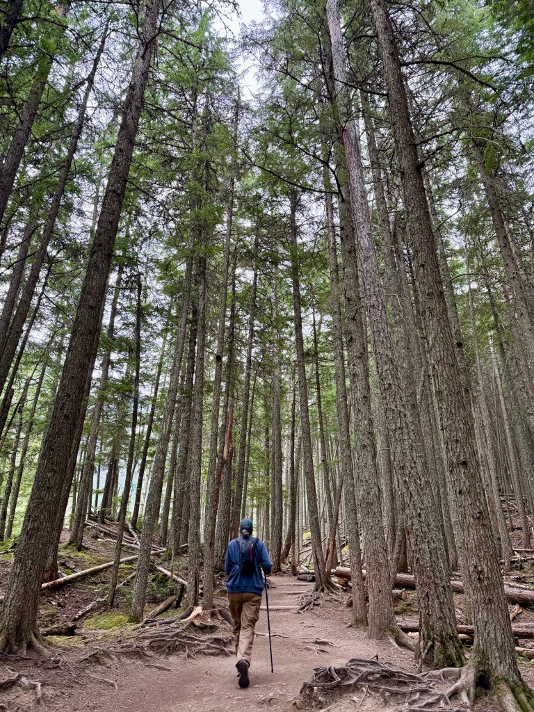
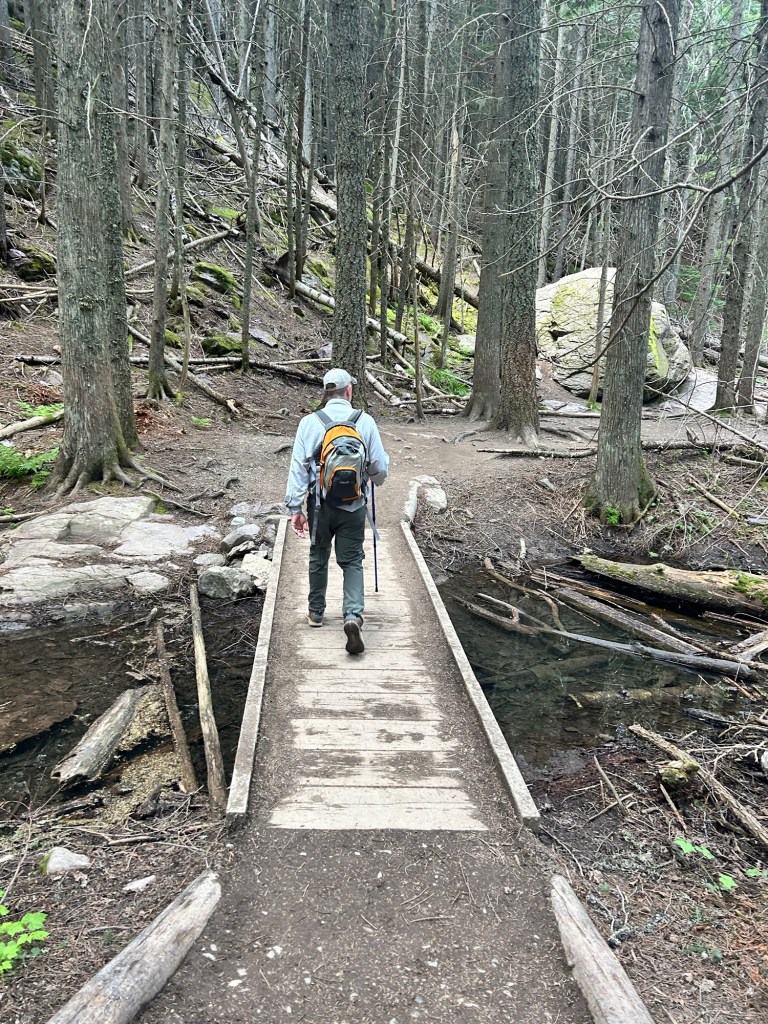
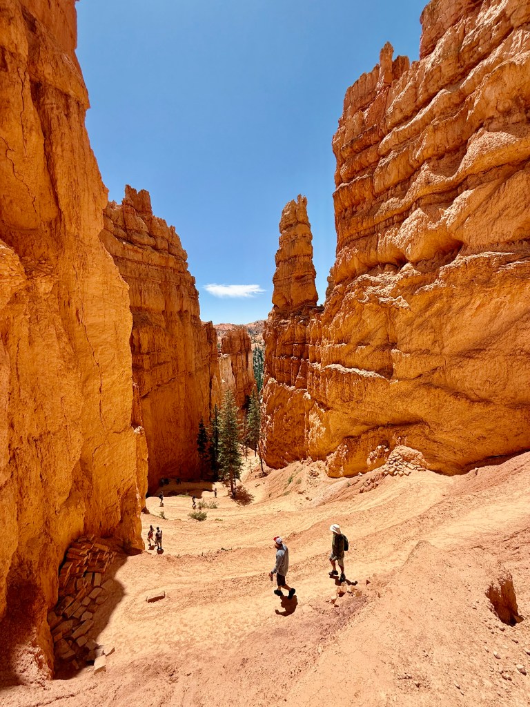
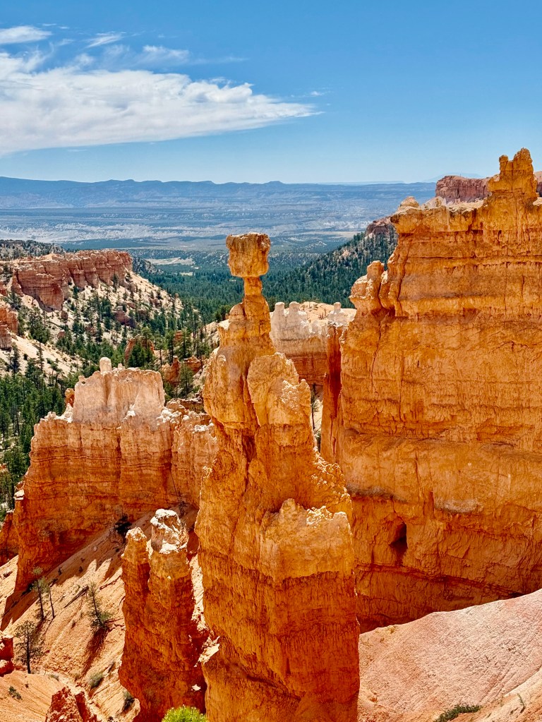
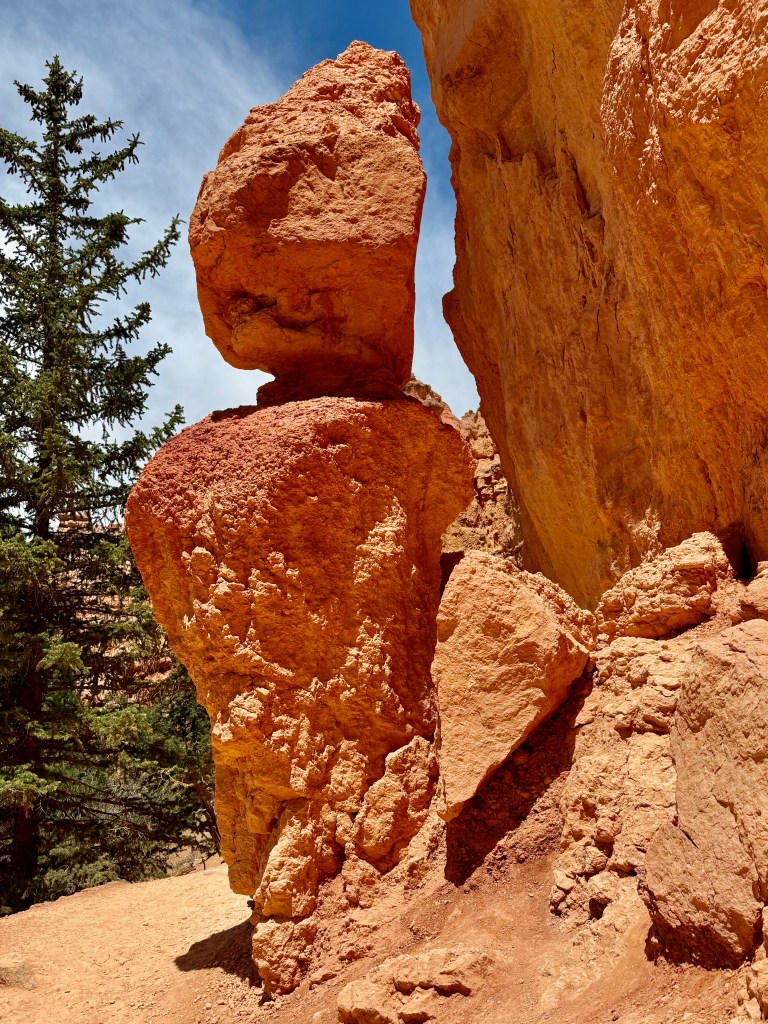
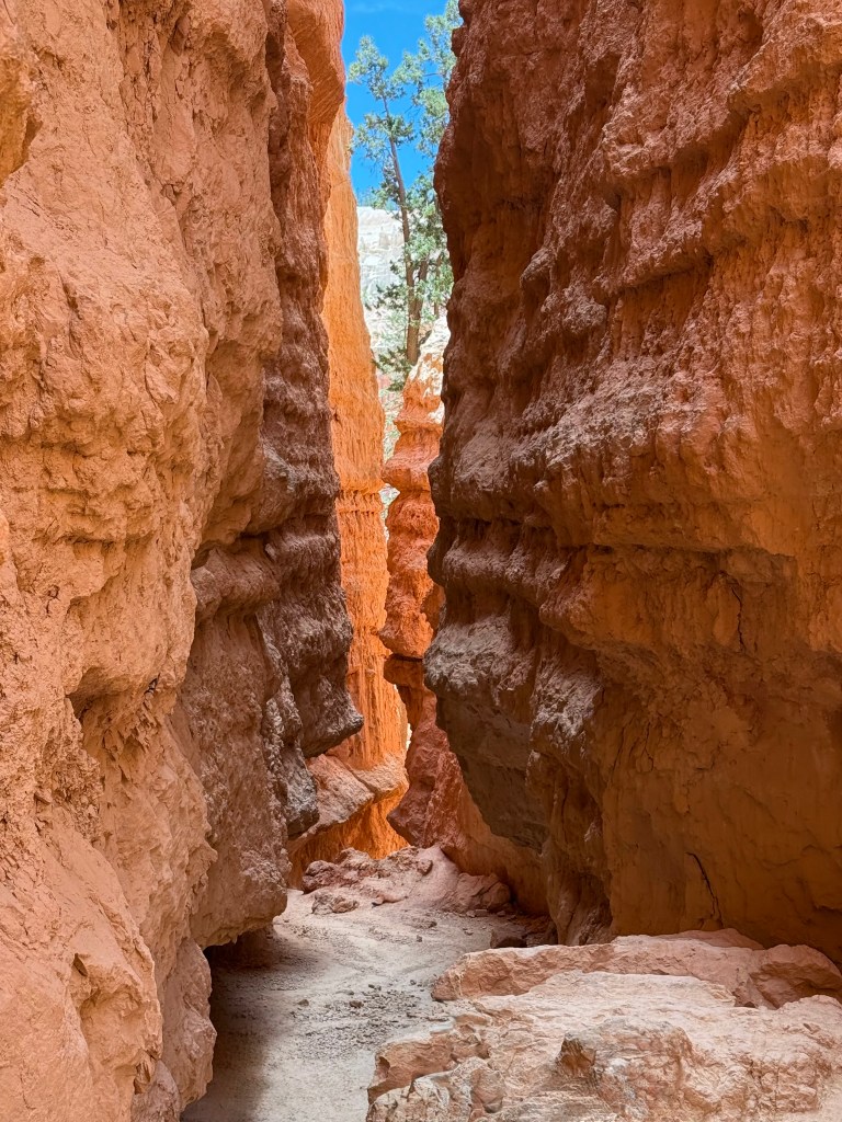
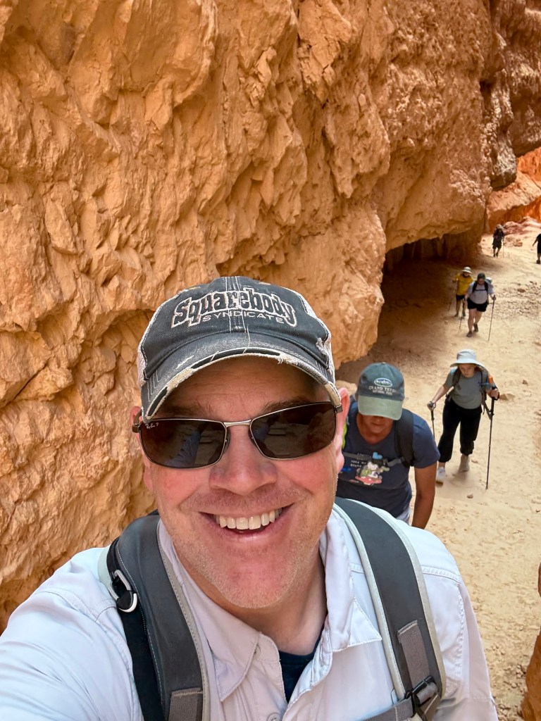
After a quick pre-hike potty visit, we set off for the Navajo Trail Loop, a trail marked as an easy / moderate 1.9 mile hike through the hoodoos and canyons of Bryce! According to the googles, hoodoos are tall, thin rock columns, often compared to totem poles, that are formed primarily by erosion. Rain, acid rain, and wind all contribute to their formation, and when melted snow works its way down in to crevices and cracks and it freezes again, it causes the rocks to split and splinter. This is apparently called frost wedging. Once there has been a bunch of frost wedgies, the result is a landscape like you’ll see in the pics. Tall rocky outcroppings surround very narrow canyons, with steep climbs in and out for the adventurous hikers.

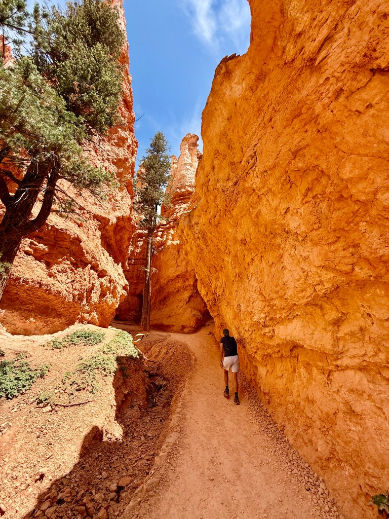
Today, we were a part of the group of adventurous hikers. We figured it can’t be too terrible of a hike, as we were following a grandma clutching her giant purse and another woman in a dress and flip flops, but right off the bat the drop offs are SCARY. Logically though, if these people can do this hike in resort wear, then we’re definitely over-dressed in our full hiking gear. Plus we have our CamelBak’s full of water and first aid supplies. Luckily, we didn’t embarrass ourselves more by bringing our hiking sticks. Geez, that would have been truly embarrassing.

It doesn’t look very steep from the picture, but it was alarmingly steep from one switchback to the next!

The steep, heavily switchbacked trail quickly led down between the massive red rock walls. As we descended, we saw an awful lot of people coming up who were really wheezing and gasping and sweating like they had just finished a marathon! Between that and the very steep drop offs from one switchback trail to the next just below, we were already getting mildly concerned about what lay ahead.

After scrutinizing the people who looked most like they were about to fall over and die, we did note that many of the struggling, wheezing, uphill “hikers” were definitely in “couch potato condition.” This gave us the confidence to just keep going and we would deal with the uphill part of the hike when it happened. We’re old but we’re not in terrible shape.

Just like many of the other national parks we’ve visited on this epic trip, we were just floored by the natural beauty of the place. Around every corner, we saw interesting rock formations, hardscrabble, twisty, pine trees that had grown straight up between two narrow canyons walls, despite likely only getting direct sun for a few hours a day, as it passed by directly overhead, and eroded terrain that must be like a raging river when the snow melts.

Apparently, while rare, hoodoos exist all over the world, but there are more here in Bryce Canyon than anywhere else. And they are everywhere. Really cool.

Hoodoo who?

Thor’s Hammer, Bryce Canyon. Well, not actually Thor’s Hammer, just kinda looks like it if you squint a bit.

We gently stepped and sometimes lightly skidded our way down the trail to the bottom, losing elevation with every single step. As we progressed, we noted that most of the people of Walmart, who we had passed at the top were no longer passing us coming out. Huh, they must have turned around. (Note, the subtle foreshadowing!)

We reached the bottom of the loop, which curved clockwise to begin the climb back up. It didn’t take very long at all before the light chatter stopped completely and heavy breathing started. Mind you, we were back up at 7,000 feet or so, and us Florida flatlanders were just not used to this.

Crap, it’s a long way back UP!

We climbed and climbed, passing neat rock formations and finding rare shady spots to just breath for a bit. The number of pictures slowed down considerably, especially the ones where Ben, trotting along ahead, would cheerfully say “Smile, Ann!” and Ann would mutter something darkly under her breath before grimacing for the camera. Before long, Ben was huffing and puffing too, and the camera BS came to a stall.

Dying, yet acting cool for the 📸

As we climbed, we started passing those same clueless folks that had no idea what they were about to get in to! We even passed a big old dude, just raw-dogging the hike in a tank top, sweatpants and sandals, with no water, no hat, no walking sticks. We would have warned him, but we were too busy doing our own impression of couch potatoes, breathing heavy, looking kind of desperate, and sucking down water from the camelbaks we were both wearing and CURSING ourselves for not bringing our walking sticks. DUMB DUMB DUMB.

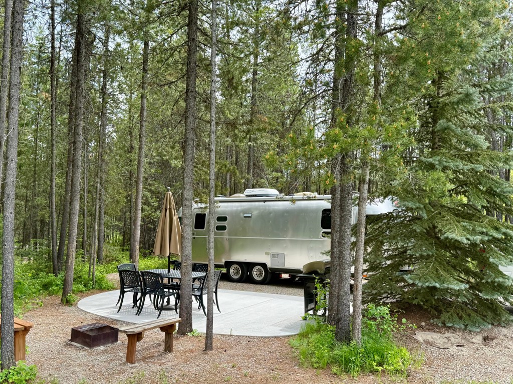
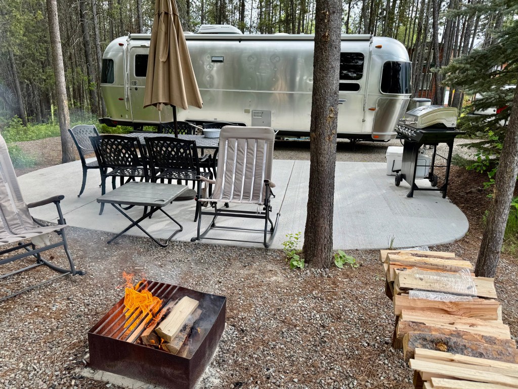
We eventually made it back up to the top of the loop at the parking area, incident free we might add (there was panic in the last 1/4 mile of the climb but it’s hard to poop your pants when you’re dying!). We headed for the truck, then to the visitor center to purchase our official visit sticker for the Airstream and then began our two hour drive back to Zion. While invigorating and great exercise, it was face meltingly hot and we were ready for a cool drive back in the AC.

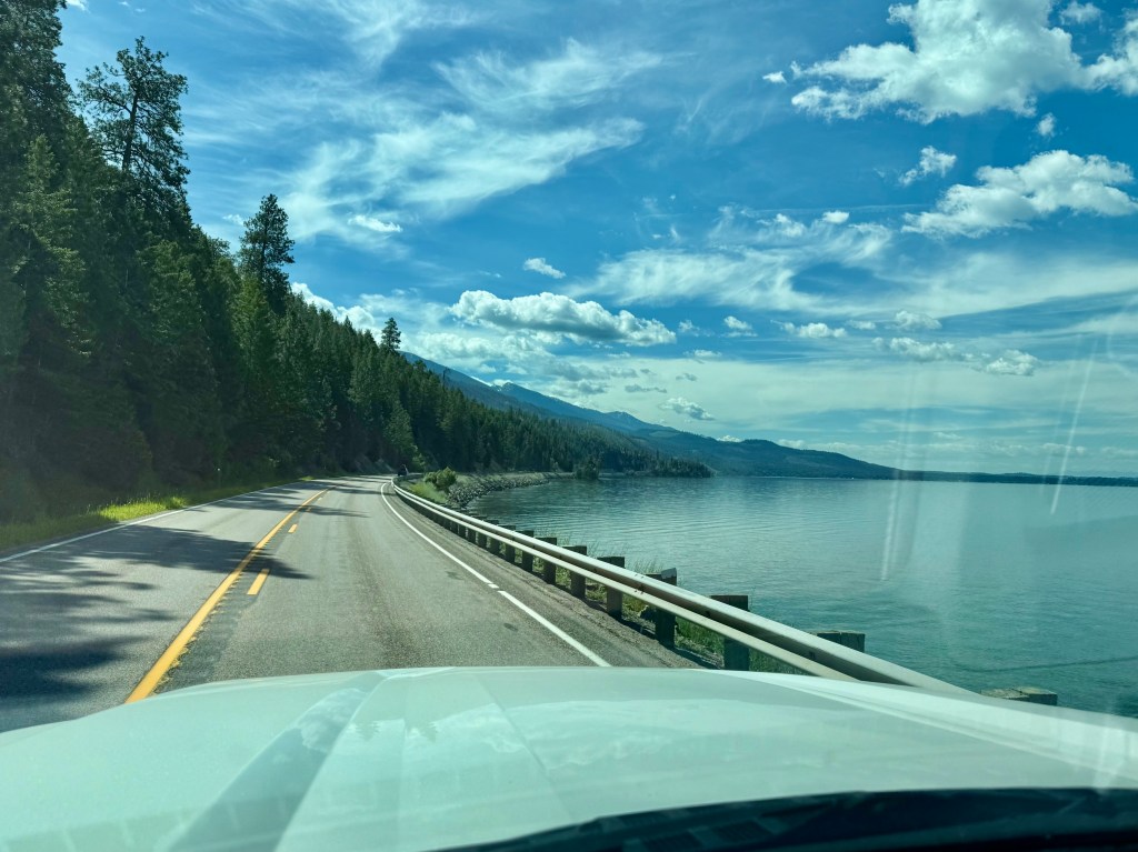
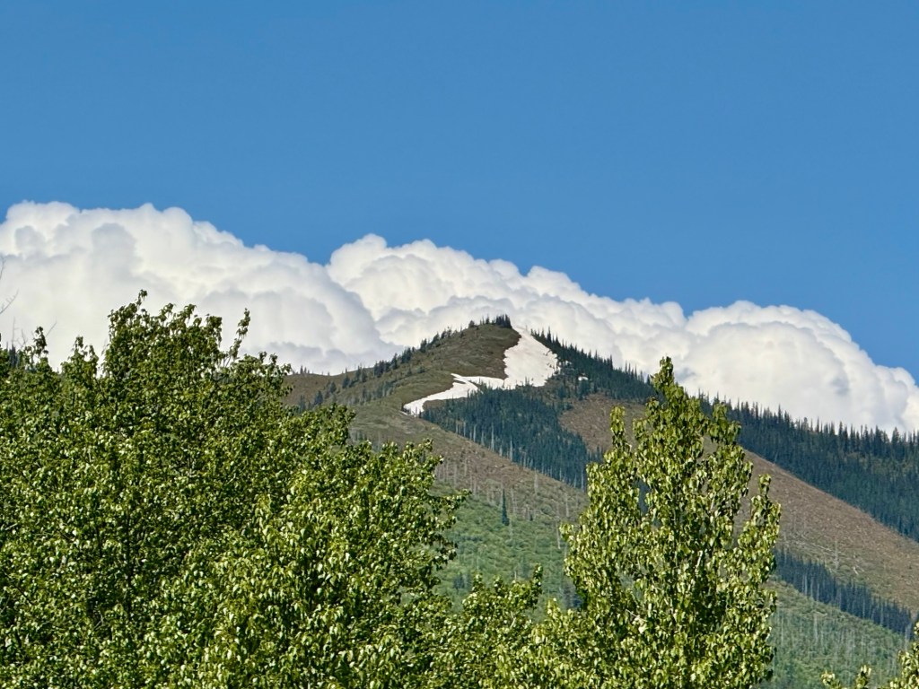
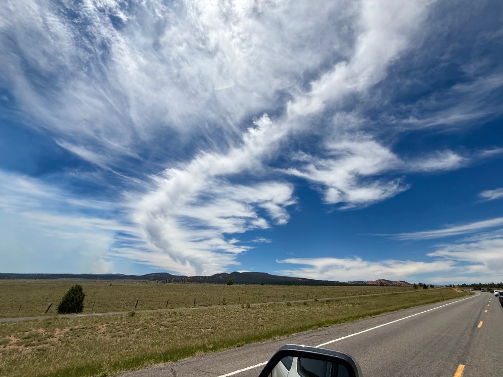
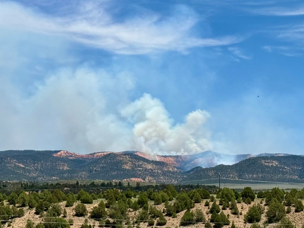
We cruised back towards Zion on the same beautiful highways that we had driven that morning. We had passed what appeared to be a forest fire on the way up and had googled it to see what was going on. Turns out, it was a 1900 acre fire that had been burning for three days. We saw a helicopter flying overhead with the little water bucket thing, so the forest service was all over it. All we could do was watch from a very far distance as the fire quickly spread through uninhabited forest. Got some neat pics though…

Dixie National Forest fire 🔥

Just as we were about to go back through the long tunnel leading in to Zion, we saw a herd of bighorn sheep just chilling on the side of the road. What is a group of desert bighorn sheep called? A band? Who comes up with these? Anyway, there they were.

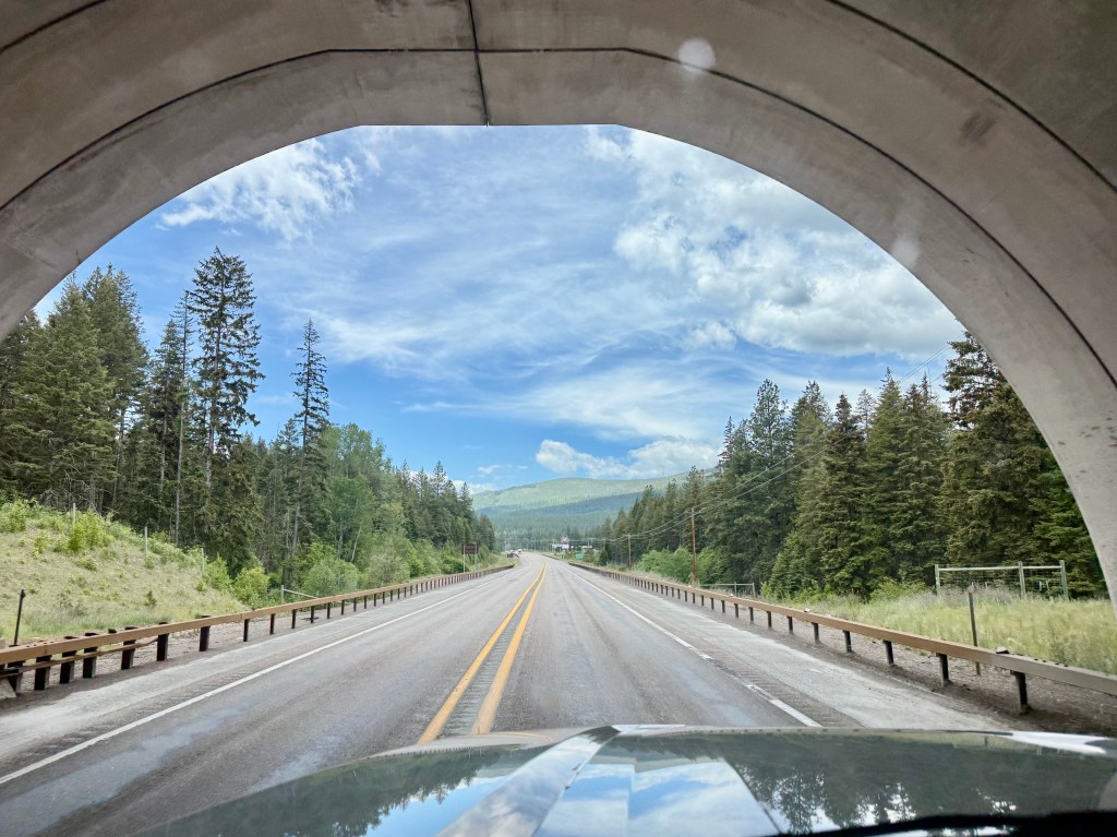
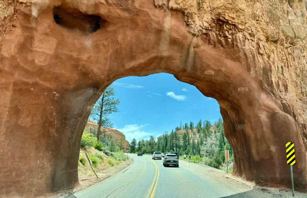
Finally, we passed through the Zion – Carmel Tunnel and made our way back to the airstream far below to just chill for the rest of the afternoon. Here is a video of us coming through the tunnel.

Not sure what day we will publish this, as it usually takes us a couple days to finish writing, editing, and posting these little stories, but in our universe, it is Fathers Day today. We wish all of the fathers in our vast audience of about nine readers a great, albeit belated, Fathers Day! While we would have loved to spend the day with our fantastic adult kids, they have to work and we don’t, so there you go.

E-Biking Zion – THE Way to Go!

We worked really hard to plan for every possible uncomfortable situation that could arise with another bike ride. We definitely wanted this Zion bike experience to be more pleasant, compared to our chilly, posterior-pounding Glacier bike ride.

First of all, we don’t have to worry too much about snow on the road or freezing to death on this ride because it’s hot as heck here in Zion, so no need to pack extra layers or gloves. Secondly, no need to carry bear spray on our hip here, as we’re told that Zion isn’t really home to too many bears. Thirdly, my privates are mostly healed up and the butt cheek bruises are mostly faded from our Glacier bike ride. BUT JUST IN CASE, I made a very recent padded undergarment purchase, aka an “insurance policy,” so there shouldn’t be any pain today and I’m told my butt should ALSO look more shapely. 😉

With my butt padded, our packs loaded with water, protein bars, important first aid stuff (that we’ve luckily not needed, thus far) and “pottying in the wild” supplies on our backs, as well as hiking poles wedged into Ben’s pack, we set off for the bike rental joint at the early hour of 8 am. I am NOT bright eyed nor bushy tailed at this time of the morning. We’re breaking my 9 am rule, simply to beat the heat.

When we arrived at the bike rental place, the first thing we noticed was that the seats were made for actual butts, instead of hyper tough and athletic steel butts. We might be in for less butt-punching today with the granny seats. 🙌 Aren’t they big and beautiful?

A real seat for a real butt! AWESOME
He’s so handsome lol

We got the 30 second training on the use of the bikes from the rental dude, made a last minute air-conditioned bathroom stop, and we headed out on the little highway that leads from the base of the canyon all the way to the top, where the Narrows hike is located. Again, now we only had to contend with the busses on this scenic drive, which was perfect! Finally, we could look out the left side of our bikes to see the old rock slide area instead of seeing an armpit or an ass on the bus! Everything outside smelled a lot better than that bus too!

What a difference it was to be on bikes vs in the sardine can bus. It was night and day! We engaged the little electric pedal assist motor and just cruised silently and effortlessly up the road.

The views were just amazing! We biked all the way up to the top of the mountain, then turned around and glided back down for a while. When we wanted to stop for a pic, we stopped for a pic. For example, not far down the road from the top, was a sign for the Great White Throne! Now, by now, you should be well aware that any roadside throne must be investigated to prevent future incidents. We looked around for a while, but figured this must be metaphorical. No secret pooping places out here, sadly.

Haha! Ann’s kinda place except all she found was ⬇️
Not a throne, not white and OUCH!

We got back on the bikes and headed on down to stop 6 to use the prequalified potty’s there, then down to stop 5 to start our hike. When we were here 18 months ago, the bridge was still shut down, so at that point, we accidentally made a 3 mile hike in to an 8 mile hike, which included 4 miles of horse poop path.

This time, the bridge was repaired and open, and we were able to get in a nice hike, with no surprises of either kind, other than finding places for Ben to pee. Geez louise, if I’m the number two machine, Ben pees enough for both of us. I swear, it’s every 15 minutes! Thankfully, men don’t have to go through nearly as much rigmarole to take a whizz as women do. Just a glance up and down the trail, find something interesting to aim at, and let her rip, tater chip. By the way, I argued with the iPad for several minutes over the spelling of rigmarole. It is clearly missing another “a” somewhere, but I am not going to argue any more. (Rigamarole)

Made it back to the Emerald Pools, not sure if it was the upper, the middle, or the lower pool, but it was definitely greenish and pool-ish, so we went with it.

We finished our hike, and headed back on down the road on the bikes. The bike ride alone was totally worth doing, and much like the drive up the Zion Carmel Highway, if you only have time for a few days in Zion, just rent the bikes and cruise the road. Amazing experience.

The road was ours!
Lots more bushes and stuff to hide behind on this section of road.

We wrapped up the bike ride with no sore butts to report, and headed back to the airstream to cool down.

Tomorrow, we’re taking a road trip to Bryce Canyon National Park. It’s a two hour drive through stunning scenery, and while we made the same trip in 2023, my stupid pancreatitis attack kept us from enjoying it. Back then, we were only able to drive into the visitor center, see that there was no parking for a truck and a camper, we let Pepper out to take a number two (passive aggressive, I know, but she did have to go, so….) and then we left.

This time, we’re just making a day trip with the truck, so parking should be easier. Also, there doesn’t seem to be any pancreatitis issues this time 🙏🏻, so we wanted to give Bryce National Park another shot.

And if we don’t like it, perhaps one of us can leave a number two there. You never know…

Zion is Pretty…Popular

Unbelievably clear skies last night as we settled in to a FINALLY cooled down airstream, and we were able to get a couple pics of the canyons surround us.

Great campground, but holy guacamole, is it sunny and hot! Thankfully, we had a nice big fat tree over our site, and we backed that Airstream as close as we could to that tree, nestling the butt of our camper right up to the trunk, and wow has that made a difference! Much more pleasant during the heat of the day.

Ben had a 5 am board call and was able to get another pic of the deep blue, pre-dawn sky. Stars still out!

Since Ben rudely interrupted my sleep and I was up anyway, we decided to get in an early morning hike and see some areas of the park we never made it to, on our last visit. It was already toasty pretty early in the morning, so this was the only way to beat the horrible afternoon heat.

We ended up finding a little trail head, thanks to social media (begrudgingly and surprisingly!), on the far end of the road that climbs and twists back on itself many times on the way through from one entrance of the park to the other. Just the drive is worth the visit to the park. You wouldn’t have to do a single hike, you could just drive this road and pull over at the little pullouts along the way to look around, and just explore the park that way and still be overwhelmed.

We popped through the very narrow, very dark 1.1 mile long tunnel at the far end of the park and had to drive a bit down the road to find a parking spot that we could squeeze our oversized truck into. With the sun beating down on us already, we suited up, and started hiking back towards the beginning of the trail. As we approached the trail head, we noted a VERY IMPORTANT structure, available to incident-prone hikers. And it was modern! Well, modern in the sense that it was slightly bigger than a porta toilet but it still didn’t flush. lol

Ben being artsy fartsy lol
Ugh. Ben takes my pic coming out of EVERY bathroom. 🤦🏼‍♀️

Speaking of incidents. I know we got off to a rough start with the, ahem, trail one of us left through a string of national parks stretching from Colorado through Wyoming and Montana, and back through Idaho and now Utah, but this Zion Canyon area takes me to another level of “concern.”

Up in Tetons, Yellowstone and Glacier, they had green things growing out of the ground in various shapes, sizes, and densities. Trees, bushes, brushes, weeds, wild flowers and grasses. Lots of places to hide behind, in the event of “incidents.” Here, NOTHING. You’re either jammed in to a fairly tight canyon to do your business, or you’re pretty much completely exposed. Unless you’re wearing all tan or brown, you’re gonna be visible. FOR MILES.

Even if you think you’re “hiding,” in this particular national park, it’s guaranteed that there’s someone there. High visibility and a ton of people are both terrible for my emergency bathroom options. If we ever return to Zion for a third time, I definitely need a military style, tan, camo net that I can squat under and a bigger backpack to fit it in. ✅

Just as a side note, there is no such thing as a “silent fart” in a canyon. Can someone tell my husband that? His excuses for why he keeps trying to get away with it, just don’t fly with me. 🙄 How he make those kinds of noises ALLLLL day and doesn’t have an emergency, is beyond me.

So anyway… we hit the trailhead at Canyon Overlook Trail, and immediately started climbing up in to the canyon, away from the little road behind us. This whole canyon is just red and grey rock in various stages of breaking down from mountain to boulders to rock to pebbles to dirt to dust. All piled up on top of each other. It’s lumpy and dusty and there are awesome places where, long ago, relentlessly flowing water just carved big swoops in to the solid rock, or where bigger boulders piled up, all shaded (mostly) by steep, narrow canyon walls above.

We had a couple of scary height spots, but a pretty neat hike. We were both thinking, Hmmm, I thought it would be busier here. Turns out it was, just not where we were. More on that in a moment.

It was a fun hike! A mild, near incident averted by the pre-reserved bathroom, and we decided to go back, pack a lunch, and head in to the park via the shuttle just to have a picnic by the Virgin River and plan the next day’s adventure.

The road in to the park itself is closed to cars, so you need to take a little shuttle in to the park, or since we are really close to the park entrance at this campground, you just walk a half mile. Then, you take the shuttle that only operates inside the park, and you get off at one of 9 stops, from which you can check out the local trail heads and overlooks. Decent system. Designed to move tons and tons of people through the park.

Full of excitement and hope, we set off for the shuttle. We loaded on to the shuttle and found our place to stand, where we could hang on easily. It was like being in China because the people kept coming on and kept coming on and kept coming on until finally we were, as Ben said, “nuts to butts.” A bulging shuttle, packed with a Walmarts worth of people trundled up the hillside toward the bus only area of the park. Our operator was bright and cheerful, as she described what was going on around us and what to expect as we rode our way into the canyon. If you look to the left of the bus, you’ll see where rockslides have taken out the road several times. We both turned to our left to look at what she was describing and our only view was the hairy armpits of people standing next to us, who were also holding onto the railing above. When the tour operators said blah blah blah is on the right, we decided not to take our chances, and just stayed staring ahead.

We made it to the last stop and the top of the park. The last comment from our cheerful driver was that it was unsafe to go in or near the Virgin River water, as there was an outbreak of some kind of algae or flesh eating bacteria (not sure which she said 🤔). That little announcement made us decide to just forego the river side picnic and just have the picnic right there at shuttle stop 9.

I MUST comment that the beautiful modern bathrooms at Stop 9 were mysteriously closed and a parking lot full of porta toilets had been substituted for the beautiful modern bathrooms. Hmmm. I can’t help myself and I never miss a chance to “go,” but these were GROSS. Every door I opened had a potty full to the TOP and not a stitch of TP. I didn’t have to go that badly. Pass! Moving on.

Gluten free sandwiches with BBQ chips in front of my fav closed bathroom.

I’m not sure why, but squirrels just come right up to me. I’m a whisperer of sorts lol

Even as blazing hot as it was, we decided to hike down to the start of the famous Narrows. We had no intention of going through the narrows today. Just hiking up to them. Hiking the Narrows requires that you basically walk in the river (which according to our bus driver, was apparently tainted at the moment), going from ankle deep to some places waist and chest deep. Depends on the season. Looked like a wet day from the folks that were coming out with their shirts half wet.

It was a neat hike for the most part. Beautiful canyons on both sides of us, neat river running through the middle, and THOUSANDS of people doing the same thing we were. It wasn’t long before we felt like we were in a line at Disney and we weren’t enjoying the scenery as much. We took a deep breath, stepped off the path for a while to let the crowd ebb through, and we turned back around towards Stop 9. It was still beautiful, but we were just peopled out.

We loaded back on to the shuttle in the same manner as before, this time saying, let’s sit so we can see the sites that they were talking about on the way up! Almost as soon as we said that and sat down, then the bus, once again, filled up to capacity, and now, instead of armpits, we had a couple of foreign traveler butts to keep us involuntarily occupied for the duration of the trip. Speaking of that, the driver cheerfully announced that we would be making every stop on the way down the mountain to pick up more travelers, so pack in! Uggh, many butts later, we pooped, err, popped off the bus, beelined for the camper for a well deserved “stay away from people” break.

Tomorrow is e-bike day! We went hunting in the tourist trap stores and found a pair of expensive padded bloomers for me to try out and hopefully, this time, it will be a better ride!

Park City / The Drive to Zi-on, Zi-an, Zine

After a quiet ride down the highway from Idaho, we had planned to stop by Bear Lake, which sits sidesaddle in both Idaho and Utah, but a headache snuck up on Ann, so we decided just to head straight down to the campground in Heber City, just outside of Park City, UT.

Ben and the skiing gang have skied Park City two or three times, and always thought it was a really neat, although very busy and very pricey little ski village. It was neat to see it in the summer. There was a ton of maintenance under way and lots of rushed remodeling to take advantage of the short construction season.

Since Ann wasn’t really feeling up to cooking, we decided to grab dinner at one of Ben’s favorite Thai restaurants, on Main Street. Nothing like a little curry to cure a headache.

As we got closer, there were clues that something wasn’t quite right. Either an apocalypse had hit while we were finding a parking spot, just one street over, or there was some kind of emergency situation we had accidentally snuck ourselves into. No one was around on Main Street and there were only emergency vehicles blocking both ends of the street.

The best way to get where you’re going when things don’t look good is to keep pressing on, right? So, we kept walking to our restaurant destination, expecting someone to start yelling at us or Zombies to pop out of nowhere. We finally made it to the Thai restaurant 10 minutes before our reservation. There was one dude who came to the door to let us know there had been a natural gas leak and the area had just been cleared. Apparently, he was the only staff that showed up once the area was cleared and he didn’t seem too confident that he could produce our dinner by himself.

Well poop, lol. We’ve had hail storms, tornadoes, close bear encounters and bike seats made of granite on this trip. Some little old gas leak wasn’t going to ruin our date night.

We didn’t get our planned Thai food but thanks to the need to evacuate everyone earlier, we had no competition for a table at the next restaurant up the block. Sushi is good too!

The only other dude that we could find in Park City.

Our plans for the next day weren’t really defined but we knew we had some errands and chores to do before heading on to our next adventure in Zion. All our bloomers needed to be washed again and the refrigerator and freezer needed to be restocked before we hit “no grocery store” land.

It was about the time we were planning our strategy and reaching out to a local friend that we got a message from a local family member. We were aware that we had friends, as well as family somewhere in Utah but did not realize we were camped almost in their backyard! Thanks to THIS VERY BLOG, we realized our proximity, and we were able to shift up plans and spend some time with our cousins (or third cousins, twice removed, thrice baked? I never understood that stuff). We met them at Sundance, which I also knew was somewhere in Utah but didn’t realize it was 20 minutes from us. Really a special place and we had a blast catching up with John and Nancy!

After a lovely dinner and great conversation at the Owl Bar, at Sundance, we walked around the home base resort of the famed film festival and got some of the history of Sundance. Really a pretty cool place and absolutely stunning scenery. We said our goodbyes (knowing we’d see them in about month at our family reunion) and made our way back to the campground.

Once back to the campground, we spent our last evening in Heber City hanging out under the stars, with our little tiny airstream just mashed between monster mega busses and extended length 5th wheel campers. We really felt like the little kid brother camping with the older kids. But ours sure does drive and pull pretty easy! 😂

Once it got dark, we snuck off to the “adults only” hot tub area in the RV park. We felt the need to investigate what exactly “adults only” meant. We’re still kinda new to the RV park/resort thing, so we’re still learning about all the little intricacies and subtle, unwritten details about campground etiquette. We were really hoping “adults only” just meant no kids allowed, but we quietly feared that it might mean suits and trunks were optional. You don’t always find the sexiest age group, nor body type hanging out at the RV pool. No offense to our fellow RV park hanger outers. These scenes are not typically Miami spring break type of scenes. The truth hurts lol.

We had to sneak up thru the bushes to get a sneak peek.

Anywho, there was one other couple there and they had suits on (thank goodness!) and there was a lingering whiff of weed coming from the cozy fire pit area. This is Mormon Land! Hmmm. The little rec building attached to it smelled like Mac & Cheese (evidence of the munchies!) and although yummy, there’s not much “adult” about it. Pretty boring scene here at the “adult only” pool area. Plus, as adults, the lights were turned off on us at 10 pm. Don’t worry. We showed them! We didn’t leave the area until 10:20 pm. Honestly, they should have just called it the “Old Fart Pool Area.” There weren’t any kids allowed and, to our great relief, that’s as special as it got.

The next morning, we packed up under the blazing sun and headed south towards Zion National Park. We were informed that we were pronouncing “Zion” incorrectly by a few of the locals. We had been pronouncing it like Zaiii – yaawn, and apparently, it is supposed to rhyme with the word “lion,” which with a slight southern twang sounds like “lyin.” So “ZI-uhn”. We practiced for the whole five hour drive. Then we pulled in to the campground and we were welcomed with “Welcome to Zaiii-yaawn!”

So we just gave up with pronouncing it correctly. Just by looking at us and hearing our voices, they’ll know we don’t belong here. Using the phrase “ya’ll,” is a dead giveaway you’re not from around these parts.

We were here back in late 2023 on the retirement tour. We loved the area and really thought it was just awesome, and we did get in a great hike to the Emerald Pools while we were here the first time. However, after eating a new food last trip, Ann got sick and we had to cut the visit short. That’s why we decided to come back, so we could give it another shot!

We had picked a shady spot which we had noted the last time we were here (that’s one of the perks of returning to a place you’ve already camped I guess). Got all set up, and will be hitting the park in the morning!

Snake River Canyon

We had a blast earlier this week visiting friends in southern Idaho! Had a really good time with Michael and Therese and they were absolutely tremendous hosts! If you’re ever in the area of Buhl, ID and have need of an outstanding AirBnB, look no further!

First, about the area we were in, let’s zoom out for a moment. Way out.

Basically, this is high desert. But it’s not totally arid, the ground is certainly fertile. Lots of agriculture on what otherwise would have just been a relatively flat, very wide plane. Lots of fresh water readily available because the area sits on top of an aquifer comprised of basically old old old lava. It’s stuffed with water so the irrigation has been simple as the city has developed over the centuries, and there are several large geothermal plants that make power where the water really flows out. Big challenge as the city grows though.

Here is the really cool part though; they figured out that 10,000 – 15,000 years ago, there was a huge lake on the plain. How they “know” this, I’m not sure. Did they find a 15,000 year old highway sign from before the flood, or something? 🤔 Anyway, we’re talking a HUGE lake. Lake Bonneville sat in what is now the Great Salt Lake Basin. But it was way bigger. 32,000 sq miles. The size of South Carolina. Bigger than Lake Superior.

So, what I am saying, is it was big.

And the natural dam that had contained the lake gave way.

They figure a 410 foot tall wall of water ripped down through the river valley below at 70 mph. At its peak, 33 million cubic feet per second of water flowed across the Snake River Plain. It ripped along, wide open, for 6 weeks (Again, how do they know this?) and then slowed to merely a massive torrent for another year. They’re guessing 380 cubic MILES of water. And it carved out this massive canyon for a long long way downhill, and left rich, fine, crushed lava, silt, and organic stuff to line the valley, while the solid cliffs stood sharply on either side. And the plump aquifer that had lain quietly beneath the topsoil and surface material was now just rent wide open, its capillaries and arteries and veins all severed at the new breach, and waterfalls have just gushed out to fall to the wide, rocky, snake river far below.

Did I say that this thing is 600 feet deep?!!

Waterfalls taller than Niagara Falls (by 15 feet, but still)

There is a bridge here where it’s legal to BASE jump / parachute off of it, and people do. Sadly, people also jump to their certain deaths from this bridge.

Perrine Memorial Bridge, Twin Falls, ID

It’s a pretty low key group of mostly life long Idahoans and Covid-inspired transplants from the usual places, who populate this thriving community atop the two, now opposing cliff sides, both looking down on a wide, green, lush, valley far below with a meandering, wide river. The entire community is solidly perched upon this crack, and the residents casually drive up and down the many graded and twisty roads to go in to or out of the canyon. It’s just so normal. All ag, most commercial and industrial stuff, and most retail, is up on the plains above. Lots of residences and some light commercial like restaurants and gas stations, and marina are down in the valley. 

A typical exit from the valley below. The Grade.

Honestly, if this hadn’t blown up in to a town centuries ago, as it was a fantastic place to hunt, fish, be protected from the elements, this would 100% be a national park. 

Hydroelectric generators and power stations run off of the water pouring down the falls or gushing out of the ripped open capillaries from the aquifer and they power EVERYTHING and almost everyone has a spring somewhere close by for fresh water. At least in the valley.

As the Snake River winds its way downhill towards Washington State, it is still a very wide and fast moving river, but due to the way it was formed, it is also very rocky. Rocky to the point where no one has a boat with any kind of hull depth or draft, as it would crash on the barely submerged rocks, where only the locals can safely navigate. Kayaks and jetskis are everywhere. It is a beautiful river to explore, as there are many falls, and quiet coves tucked in where rock was rapidly deposited during the flood.

Industry has also taken a good foothold here as well. We saw lots of ag on the plains and in the valley. Clif bars are made here. Chobani yogurt is made here (barf). There are also a bunch of trout farms that sell to big time restaurant chains.

It’s such a neat place.

You definitely should not go (say the locals lol). Yuck.

Shoshone Falls, with hydroelectric power generation. This is the one bigger than Niagara Falls. In terms of total distance pool to pool
They say it was one big mutha of a flood that just ate this all out in one shot. Wild

Secretly, we loved Idaho but we’ll respect the locals and not dish all their beautiful secrets to the four people that read this haha. Idahosanites are just fine with everyone believing that Idaho = POTATOES 🥔

Is it Getting Hot in Here?

We spent our last evening in Glacier lightly packing up after our four nights here, looking at maps for the driving day ahead of us, relaxing by the campfire in the best camping spot we have ever had, and icing down Ann’s sore booty from the great biking adventure.

Packed, fed, relaxed, and buttocks iced, we hit the sack, ready (sorta) to hit the road in the morning!

As a process check, we’re about halfway through the trip, depending how you measure it. In total time on the road, we’re not quite to halfway. In total number of nights that will be spent in the airstream, we are at 24, with 24 to go. It is actually going really well!

The airstream is certainly cozy. Storage space is at a premium but we’ve managed to organize and reorganize throughout the trip to make things more streamlined. However, it’s amazing how things still get “lost.” Considering the Airstream is approximately less than 180 sq ft, it’s hard to imagine things can get lost but we’re still looking for an avocado we bought two days ago. Crazy! Soon we’ll smell where we lost it. 😩 Honestly, we have to get really creative to protect anything soft while we’re bouncing down the road. So things like bananas, whole cantaloupes, tomatoes, and avocados are hard to keep from bruising in cabinets or the refrigerator. After throwing away many bruised and battered produce items, we finally started experimenting with letting the produce ride in the middle of our bed, with surround made of bed pillows to keep them safe. Even then, super horrible, crappy roads can sneak up on us, and even those tricks don’t work. Bananas, by far, are the most thrown away, unused item for this trip.

All in all, we’ve really enjoyed this trip. We’ve only had maybe 2-3 instances where we were both in urgent need of the one and only potty onboard. Thus far, we’ve resolved those conflicts with a very quickly delivered, very well reasoned argument/plea from both parties about the relative severity of the urgency. Sometimes the argument/plea is delivered only with body language and facial expressions. Whoever wins “first dibs” gives a heartfelt promise to make it fast, and a sign of commitment by leaving the phone on the dining table , so as not to be distracted.

Or Ben just pees outside. There’s only been one time, a very early morning, where Ben had to make use of the campground potty house. As cold as it was that morning, there was no other possible scenario. Ben was the only one of us that would brave those temperatures. Bottom line is that the entire trip has been pretty incredible.

On that note, we have met a LOT of people on this trip that have sold their homes and gone full time, working a bit at campgrounds for free campsites and utilities. They describe six months in Arizona or Key West, or Texas during the winters, and places like Glacier, Yellowstone, etc in the summers. People have been doing this for years and years and seem to have really figured it out and have settled in to a groove. Ann and I talked about it and said, nope. Not going full time!

Back to the topic of the present day journey, we headed out toward today’s, destination, a one night stay for us, North Fork, ID, population 299. Not 300. Wanna bet everyone in town knows the name of the dude who didn’t respond to the census?

It was an awesome drive, this time skirting the eastern shoreline of Flathead Lake, a huge, natural lake formed by glacier movement through the area. For scale, Flathead Lake is about half the size of San Fransisco Bay, bigger surface area than Lake Tahoe (although not nearly as deep), and mostly surrounded by tall pine stands all around.

Along the way, there were a ton of really cool lake shore properties and you could just tell the place was built for summer activities, with boat docks, mostly still empty of boats, lake houses with small unassuming entrance and parking on our side, the road side, but you could see that these unassuming houses opened up to expansive, multi storied, all glass fronts facing the lake. And the place was just lousy with orchards and vineyards! We were surprised to see acres and acres of waterfront orchards, mostly cherry, with clean rows, perfectly maintained grass and branches, and 8’ hog wire fences around each property, likely to keep out the deer. It was just a gorgeous drive.

At the south end of Flathead Lake, we turned on to Montana 93, another twisty, curvy, climby state highway that took us up another 5000 feet to cross Chief Joseph Pass at 7,264 feet. Once again, God was watching over us as we had nobody pushing us while we navigated the tight hairpin turns with the airstream in tow behind us, following us closely through the curves. Pictures just do not do it justice, but we tried anyway!

We decided to stop in what we thought was good old sleepy Missoula, MT to restock on groceries ahead of 7 nights in Utah. Missoula has grown up a bit since Ann harassed this place nearly 30 years ago. It was jammed in that town! Beautiful scenery and the city has largely kept up with the population growth, but if Walmart on a Saturday afternoon (is it Saturday?) is any indication, they are still rapidly outgrowing their britches. We picked up what we needed, shoved the groceries and supplies in every nook and most cranny’s that we could find, and continued on the drive down to North Fork.

2.5 hrs after leaving Missoula, we pulled in to the Wagonhammer Campground, perfectly perched on the side of the Salmon River, with plenty of afternoon left for some downtime. We topped off the truck, cleaned up the airstream, had an relaxing dinner, and in the morning, we are headed further south to stay with a dear friend and his lovely bride in southern Idaho. Looking forward to meeting new friends and reconnecting with old ones!

Oh, forgot to mention the weather! We are back to the heat! We started getting used to 70 degrees being hot during the day, which it was at 3000-8000 feet, but the nights were really chilly, getting down in to the mid 30’s.

That changes today, apparently.

We pulled in to North Fork with air temps in the upper 80’s. Hot dang, that meant someone had some leg hair to shear off and the shorts were coming back out. With not much else to do in North Fork, Idaho, a good chunk of Ann’s evening was spent with a razor in hand!

Let’s go for a ride!

Holy moly, what a neat experience!

It turns out, every year, the Going-To-The-Sun Road is just too high and too deeply buried in snow to remain open. This is the main drag through Glacier National Park. The road is 50 miles long, with a really tight and high stretch in the middle, making it difficult to maintain in the face of heavy snow, avalanches, high winds. Pretty rough place in the winter.

But as warmer weather hits, the snow starts to melt, and once the roads are mostly clear, the park opens for the season. It is usually at least another month or more before the big road is fully open.

Until then, they have this pretty slick idea in place. They still have the blockage only at the very top of the peak, but they close the road waaaay back, more than 15 miles from the closure. The road is completely closed off to cars and trucks. But cyclists and hikers are free to travel its length, almost to the closure!

The only thing you really have to be aware of is the wildlife that likes to stand in the road. They obviously haven’t gotten the memo that the tourists are back. There were a few points in the road where we felt deer were about to chase us off but they eventually decided to move out of the way. FYI… a dorky bike bell does NOTHING to get them to move off the road. You just have to ride and hope they run off away from the road. 🫣

Other than the occasional bit of jaywalking wildlife, you can hike or bike right down the smooth two laned highway, at whatever meandering pace you want, and just soak up the absolutely beautiful surroundings. Stop at a moment’s notice to check out a waterfall of gurgling snowmelt, rushing down the mountainside to join all of the other snowmelt meeting at the bottom and engorging the river, itself twisting and turning through the valley far below.

It was already an overwhelming visit, and we were able to see maybe 15-25% of the park due to the road closure, but what we saw and experienced just blew us away.

And then to be able to just cruise through it for miles and miles as the road climbed and twisted and curved its way up through the valley and up the sides of the mountain, up 2200 feet over that 13 miles, was really something to be blessed to be able to do.

Oh, and if you will take a glance at the map of the route below, you’ll note that this was an incident free day!

We rented a pair of e-bikes from a local outfitter, and they were really pretty fancy bikes. Good suspension, disc brakes, fully integrated battery. Good, thick tires. The pedal assist bike could be off, and just be a very heavy bike, or it could be in one of four settings: providing 25% of the thrust, 50%, 75%, and almost 100%. The pedal assist really made the relentless uphill climb quite a bit easier, and they could have made it effortless at full power, but the battery would have pooted out long before reaching the top.

The bike really made the climb quite a bit more comfortable (that’s Ben’s opinion!)!!!

MY opinion is that the seat was made stone. It literally felt like someone took a piece of granite from the mountain and chiseled two small indentations, which I guess they thought seemed “close enough” to human butt cheeks and then added a granite thong to it, just for funsies. I don’t believe for a minute this bike was designed by a woman OR for a woman. It hit hard in ALL the lower, delicate woman parts. How can the first 15 minutes of peddling uphill cause the fattest part of my butt to bruise and bones in my pelvis, which at one time were flexible enough to birth babies, be shattered? 😱

Honestly, the pain was so bad that I didn’t care how dorky I ended up looking if it saved my tush. I was just on the borderline of cold when we started out, so the first thought I had about shoving one of my shirt layers down the backend of my pants wouldn’t work or I’d freeze to death. I had the perfect little pillow in the truck that I use for my lower back and that would have fit nicely down my pants and would have softened the butt punches, but it’s miles back in a random campground parking lot. Honestly, I even thought about taking the helmet off my head and strapping it onto the seat to see if that would add any cushion. I couldn’t get the straps on the helmet tight enough to stay on the world’s smallest thong seat. 🙄 The rest of the contents of my pack were useless. Granola bar, nope. A can of bear spray, definitely not helpful here. Chapstick might help my butt later but would do nothing to help now. All useless items for the problem at hand.

Even more annoying was that Ben kept taking pictures over his shoulder as HE effortlessly glided up the road. If he would have asked me ONE more time to smile before my sore neither region made it to the top, I would have seriously considered making him sleep outside the Airstream that night. Luckily he’s learned to read my facial expressions over the last 33 years.

I have much greater respect for those who ride bikes on a regular basis. I am convinced they must have been born with cast iron undercarriages, or gooches, or grundles, or even the other word, whatever they have going on down there, it must be tough.

As we slogged our way up the hill, I was making good use of the electric assist, and Ben, to his credit, kept checking in to make sure I was ok, but my dang butt just kept getting more and more sore. We would stop for a scenic view or to check out a water fall, and it was a great break for my butt and bits, but then we would get back on, and I was back to trying to find a tolerable, never mind comfortable position.

We finally reached the top, or close enough because I started seeing huge piles of snow on both sides of the road above us. That was enough for me to call it because the temp kept dropping too, so we had a quick breather and a protein bar, and started our way back down the mountain. And it was DOWN, all the way and FREEZING! And of course the sun had disappeared by then and dark black clouds were moving in.

Luckily, my legs were not needed for pedaling for a while, which was bliss because I didn’t feel them anymore anyway. What I wouldn’t give for my butt and lady parts to go numb too but oh no. UGH. At least I could raise my sore fanny off of that murderous, granite hard, torture device called a seat and coast down with my weight on one lower pedal or the other!

Down we coasted, on and on through the same twists and turns we had just navigated. Passing the fellow electric bikers meandering their way up the road, as well as the hard core, no electric assist bikers, sweating and pumping up the long slow grades under their own power. We even passed a few families, with kids in carriers on the bike, being towed behind in a little carriage or in one case, tethered to Dad’s seat post with their own bike, dragging and bouncing along behind Dad, as he worked his way up the hills.

We rode 26 miles total, through just beautiful country. We definitely plan to come back to Glacier someday with the kids, but next time I am bringing my own seat and extra padding! If you edit out all the bitching about the seat, it was a stunning day with an almost overload of beautiful sights.

The evening included regular intervals of Advil, ice and a heating pad.

Glacier Early Morning

Despite the very early hour, the chilly morning temps (34°!😱) and a very cozy airstream, we (Ben) decided to get up at 4:30 am and drive over to Lake McDonald to try to get some sunrise photos. Ann was very much hoping Ben would sleep through that silly alarm he set. Ugh!

We did catch a neat night shot last night when Ben went outside to see if there was a chance to see northern lights. No northern lights, at least not at the early hour of 10:30 pm, but the moon was rising over the pines and it created a cool setting.

We suited up, grabbed a cup of coffee, and headed out the door before the clock struck 5 am.

Team spirit! Ann is NOT a morning person. Especially a chilly morning person.

It felt like we were the only ones in the park this morning, and as we stood on the pebbly shore, a quiet, slow breeze across the surface of the lake sent gentle ripples of otherwise calm lake waves to softly lap against the millions of small pebbles. A very relaxing and unique sound. Ann described it as walking through a beach made of kitty litter, the rocks were so rounded and fine.

We grabbed a couple of pictures at a few turnouts, as well as on the bridge leading in to the park, across the Middle Fork Flathead River.

Lake McDonald
Lake McDonald
Still Lake McDonald
Middle Fork Flathead River

Then we headed back to the Airstream for a continued nap for Ann and a board call for Ben. The plan, after naps and calls were completed, was to head back out to the park for a hike. This time, we were armed with two cans of bear spray, two knives and a thorough refresh (thanks to YouTube) on how to quickly arm, aim and fire a canister of bear spray. Watchful awareness was our best friend today!

Still a bit freaked out about the bear near miss yesterday, we headed up the trail at John’s Lake Loop, a relatively short hike, but it was starting out steep. As the road dropped away behind us, we noticed that there was no one else on the trail. It wasn’t like it was early or anything, it was like 10:30 in the morning. It was also eerily quiet in this section of the woods. We felt a small sense of relief, when the first snapping twig sound we heard was a boring old deer, which was just quietly munching away, while watching us cautiously. He wandered downhill and we kept hiking up the wide, tree-rooty trail.

WHAT do we have here?!!! OK who zoomed in to look at the poop up close? Haha

Then we came across THIS huge pile of poop in the path. Like the kind a very very large bear COULD lay down. This was no dainty lady-like pile and certainly wasn’t human, as it was right in the middle of the path with no TP in sight. The very quick conversation went something like this…

Ann- “That’s horse poop, right?”

Ben- ”Pretty sure that’s horse poop.“

Ann- “Yeah, because I see grass in there.”

Ben- “Bears are omnivorous, they eat lots of grass.”

… (then there was a much shortened version of the jeopardy theme song simultaneously playing in BOTH of our brains…

Ann- “So, that could be bear poop?”

That was pretty much the end of the conversation. With no cell signal except for the one that looks like this…

The standard “shit outta signal” symbol that we get in most National Parks.

We couldn’t Google what bear poop looks like, so yep, we were out of there and there wasn’t much more discussion about it.

We did an about face and boogied right back down the steep hill. Ben didn’t wander off to take any pics, so we were moving right along.

About 1/4 of the way back down, a deer, different from the one we had seen a few minutes before, bolted behind us and off to our left, away from where we had just been.

Our descending pace increased noticeably. As we exited the desolate path, back on to the road where we parked, there was a sweet looking Mennonite family just starting their journey up the path, with no hiking sticks, no bear spray or any evidence that they knew what they could possibly be getting into. But honestly, the man looked like he was used to taming unruly bulls bare-handed and the sweet, shy woman looked like she spends her days churning butter, so we figured they could handle themselves in a situation with a bear. Who knows. We could be wrong but we’re gone. Plus, if those Mennonites get eaten, maybe the bear won’t be as hungry for US!

After getting back to signal land, we googled it. After extensive poop research over the next 20 seconds, we are 94% sure it was horse poop, and 100% sure we made the right call anyway.

We drove back toward the west entrance, once again passing the beautiful Lake McDonald, which looked different with every passing change in the sunlight. We learned that it was carved by glacial activity, it is 10 miles long and 500 feet deep, with the wide basin a result of the glaciers moving through. Pretty neat. Not a bad view for what turned out to be our somewhat limited exploration of the national park, as the main road is still closed, but we have some good news on that front in a moment.

We found a place where the clouds meet the snow.
Looks cold and mostly lonely out there!

We got in a couple of small hikes down by the river. Low key and bear free. Saw another deer who saw us, but was more concerned with addressing some deer hygiene issues.

Hello pretty non-bear looking critter.
Ewww. Surely they have designated areas for this, away from tourists!

So, in the end, we got in a respectable four miles of hiking. Not bad for a late start and two changes of venue.

The rest of the afternoon was just spent doing pretty much nothing, the weather was perfect, the windows were wide open, the sun was shining, so that was enough for us!

The plan tomorrow is to pick up our e-bikes, head up Going-To-The-Sun Road to where it is still closed for snow removal at the very top, and then we continue up the highway on bikes, for the next 13 miles! It is closed for all vehicle traffic but hikers and bikers are free to head up.

We should get some great views tomorrow!

And yes, we are both taking bear spray again!

Avalanche Lake and Ann’s Bear Encounter

We set out for our first hike in Glacier at the crack of 9:45. Ben had a call at 9, so it was a good excuse for a lazy start.

After going through the west gate of Glacier NP, and after we passed the visitor center intersection, we were officially on the Going-To-The-Sun Road, the East – West road that crosses the entire park. Once again, an absolutely gorgeous drive, which was made even better as Lake McDonald came in to view. We were absolutely floored by the majesty of the wide, glassy smooth lake, with snow capped, heavily wooded mountains surrounding it on all sides. We have to come back here at sunset to get a pic! Will try sunrise as well, but the sun comes up at 5:36 am this far north, and we are definitely adjusting to Mountain time, so we shall see. Ben does love his sunrise pics though, and Ann may be a little grumpy in the morning, but she’s typically down for whatever, so we will likely have an early morning tomorrow.

Our objective this morning was to hike the Avalanche Lake Trail, a five mile, out and back trail leading to a lake, according to our handy map. We arrived at the trail head, thanking our timing once again, as all of the parking lots were full, but the tent camping area was not yet open, so we were able to join our other tourist friends in parking in camp sites, and we set off for the trail head.

Once again, we made a wrong turn.

With minimal signage indicating the direction of the trail, and with zero GPS signal, we wandered the parking lot/ campground for the first 3/4 mile of our hike, looking for signs to lead us to the wilderness. Because she knew Ben wouldn’t ask for directions, Ann asked a group of young men who were getting ready for a hike if they knew where the trail head started. Each of the five men looked in a different direction, so that was all the answer we needed.

We continued on our path through the campground parking lot for what seemed like 30 minutes, passing three different “closed for the season” bathrooms, which might have been just one bathroom that we looped around three times, because eventually we passed our truck again. 😩 Acting cool, this time we just followed the herd and we found the trail not 100 yards from where we parked. 😅

Here is the map of the trail today, with the familiar markings that you’ve seen before…with maybe a new marking or two.

The first new marking shows the mid-trail bathroom that we were very surprised to see, which was located not far after, well, you know. The second new indicator was the very up close and personal wildlife interaction we had today. It also very nearly caused an involuntary “incident.” More on that in a moment.

The hike was absolutely beautiful, with very thick pine trees, huge in some cases, lining a very narrow and steep canyon. All along the path we either had a roaring river or sometimes a creek flowing sometimes hurriedly and sometimes lazily, through the canyon. We passed three deer, just wandering next to the trail, keeping an eye on us hikers, but not letting our passage interrupt their grazing.

Clearly not a scary animal, according to Ann’s smile.
This critter not scared by us, at all!
Ben is all smiles while Ann is just trying to breathe normally.

As we approached the Avalanche lake itself, the path narrowed quite a bit, and we transitioned from heavily wooded terrain like the pic above, to thick bushes and shorter trees. The vegetation really closed in on both sides, and Ben was thinking, what a great time for a bear to show up.

And one did.

Ann was trailing a few steps behind Ben, when to her right, in a little opening in the underbrush, there were some cute little tan outlined eyes, a cute little tan outlined mouth, a plump, fuzzy fur body, about the size of a medium sized dog, but with short stubby legs and sharp little claws. A black bear cub, just standing there, within 2 feet of Ann, watching us go by.

This IS NOT a picture taken by us, but Ann wanted you to experience what she experienced, so here is the closest in color and size that she could find on her internet search. Thank you Pinterest.

Our first concern was not the cub. Our first concern was where is the mama!?!

And, much like pooping in the woods has the effect of attracting EVERYBODY to your immediate area, seeing a bear up close apparently has the opposite effect, because there was suddenly NOBODY coming or going to help provide a noisy distraction or safety in numbers.

This is the ONE time we had forgotten the bear spray in the truck. We had debated going back for it about a mile from where we parked, but there were lots of people out, the hike was relatively short, and we figured we would take our chances since the only bears we’ve seen on this entire trip were a snoring, drooly mess, about 20 ft up in a tree and a mama bear and her clubs playing in a field pretty far away from us. MAJORLY wrong decision for today, apparently.

Ann’s initial response, after it registered that what she was looking in the eyes of was a young bear cub , was to loudly say “OH” and freeze. You’d think after thoroughly reading ALL the huge signs around the park that describe step by step what to do if you meet up with a bear, that Ann would do at least one thing right. Nope. At this point, Ben realized that something was off and turned around to see Ann’s face and it looked EXACTLY like the face she made when she thought she was being attacked by a bear at last night’s campfire. All Ann could say in her loudest whisper voice was “BEAR, BEAR, BEAR!” So, with no one around except for us, and armed with only a stale protein bar, an emergency weed gummy, a wadded up raincoat, a liter of water and a can of sunscreen to fight off a pissed off mama bear, we slowly and calmly kept walking down the path backwards until we felt we were out of danger (mostly). Luckily, the bear cub stayed put or ran the other way. Either way, we didn’t see it again, thank goodness.

We came across Avalanche Lake just 50 yards further down the trail and lots of people. We spread the word about the bear, found a couple we thought we may be able to outrun, and headed back through bear sighting country towards the trail head. The bear was long gone, although our hearts were still beating a mile a minute.

That will be the last time we forget bear spray out here!

We both thought this tree was a boy, but for different reasons. Ben said, “Look at that beanbag!” at the same time Ann said, “Look at that schnoz!”

Anyway, fun times, great memories, only one trashed pair of bloomers (🤦🏼‍♀️), but we survived our brush up with the scary bear, which has been well marketed in three different parks for weeks now. Ultimately, we knocked out a 5.5 mile hike in a little over two hours, saw some absolutely incredible scenery, and spotted a couple places for some awesome sunrise pics. All in all, a good day, and we haven’t even had lunch yet!

The Road to Glacier National Park!

Relying on the kind stranger’s advice from the day before, we decided to take a road less travelled to get to West Glacier. He said it was a long two lane twisty road that ran along the base of the mountains and followed alongside the river. We thought that sounded just about fantastic! So, we woke up early, had our coffee, found a do-it-yourself car wash, just to get some of the bugs off of the Ford and then we packed up the airstream and headed out!

And we immediately turned the wrong way. LOL 😆

After a few very terse, yet loving, comments between us, we took a deep breath, made a quick u turn through a gas station, and happy happy, off we go. It happens. It actually happens to us pretty often because Ben likes the GPS always oriented to North (boring and lame!) and Ann likes to live on the edge of her seat and have the GPS oriented in the direction we’re traveling (a little more chaotic but FUN!).

The stranger was absolutely spot on. We made our way through Montana to reach highway 83 and getting there was an amazing drive in and of itself, with neat little towns nestled in narrow valleys with a range of steep rocky hills in the far distance on both sides. It was not very heavily trafficked either, so we were under no pressure to go any faster than deemed safe for the road conditions or the sharpness of the curves we navigated. The road to 83 was just an incredible drive!

Then, we turned on to 83.

The river seemed to widen and the hills closed in comfortably on both sides of the heavily wooded valley, as we started working our way north on this quiet highway. The GPS indicated we had about 93 more miles until departing 83 for roads beyond.

As we looked at the GPS map, we saw that we were approaching a series of lakes, all formed by the river that had cut and continued to cut the very valley we were in.

As we approached the first lake on the left side on the road from us, it just seemed to open wider and wider as we started passing along its southern outlet. It was very dark, cold, glassy water, without a ripple on its surface. The trees on the steep banks, on both sides, were almost all evergreens, lush, densely packed, ranging through all shades of green, from very light to so dark as to be almost brown. The trees marched right up to the waters edge, almost interrupted.

As we passed by what seemed like a mile of beautiful lake, we reached the northern end, and it tapered to a marshy area and the road returned to being heavily wooded on both sides. We were blown away by how private and quiet this area seems. We observed a few side roads as we had passed by the lake, that obviously led to private residences. Just a beautiful setting.

And then we passed another lake, even larger and wider than the first. This one had a few houses on the slowly widening, slowly smoothing out shoreline, and the highway started moving away from the lakeshore slightly as well. These were just gorgeous homes, with dark siding and earth toned or darker roofs, fitting very well into the woods and greens that surrounded them.

We continued to drive north, and we continued passing these beautiful lakes, either still sharing a shoreline only with densely packed woods, or sometimes hosting one, two, or in the case of larger lakes, multiple cabins, large home compounds, marinas and restaurants. By far, the one that just made our jaws drop was the only one like it that we passed.

We came a round a corner on a fairly narrow section of road, and we encountered another deep dark lake. This one had a small island on it. Maybe 1/2 acre island. And on that 1/2 acre island in the middle of this quiet lake was a monstrous house. It fit right in to the heavily wooded island, but it looked like it took up at least half of the island!

As we got closer, it got bigger and bigger and we noticed there was no bridge, only boat docks. And across from the island was a smaller version of the same house on the shore, with a matching set of boat docks. Just an amazing setup. And then it was behind us and we carried on, enjoying the views.

We finally found a pull off so we could grab a quick bite to eat, and make sure we didn’t get to the campground before the 3 pm check in, (made that mistake back in Goodland KS, of all places, where we got there two hours early and they charged us $10). This is just a slice of what we saw. Such a cool road.

Eventually, we reached the northern end of 83 (having driven yet another awesome highway, end to end, on this trip), and continued on to our campsite in West Glacier, just outside of the national park.

Over the past few years, we’ve stayed at a bunch of KOA’s and we’ve seen lots of different setups, from the bare bones “KOA,” where there’s nothing to do but get a fitful nap next to the interstate (they’re usually about to lose their KOA status), then there’s the “KOA Journey,” which are nice, well organized, and with enough amenities to get you on to your next destination, and then we have the KOA Holidays, which typically are found in nicer settings, further from the highway, with wider lots, nicer common areas, and usually an bit more privacy. This is typically as fancy as we go. BUT, this was going to be a new experience for us, as we’re staying at a “KOA Resort” this time around. Ooh la-la!! Aren’t we feeling bougie today?! Does Ben need to have a tie and sport coat to check in? Are women allowed to wear hiking pants to brunch?

We were nervous, but getting a little more excited as we meandered down the long winding road to the main entrance. It was at the main gate that we spied the maintenance guy picking his nose, just before he excitedly greeted us with a wave. It was at that point we relaxed a little and figured out that the tone was a little bit less formal than we had feared. Ben took a deep breath, relieved to know that he was still going to be able to pee in the woods surrounding our campsite. Resort just meant you “should” put shorts or pants on before you exit the camper to pee in the woods. It would take a little reminding for Ben, but those kind of “resort rules,” we could handle.

Once through the gates, we pulled in to a really cool, well maintained check-in area. We were then led by golf cart through a winding, well landscaped, heavily wooded little set of neighborhoods of campsites, populated by everything from pop up campers to 60’ diesel class A’s, with two stories and six slide outs, and everything in between. We reached the back corner of the campground, through some rows of cabins and backed in to perhaps the nicest campsite in which we have stayed! We honestly didn’t believe the oohing and awwing of the front desk ladies when they all told us out campsite was their favorite campsite. Once we saw it, we understood why.

This place is really nice! Our campsite is really private and we were able to open up all of the curtains without having to make direct eye contact with everyone in the park. It really doesn’t feel cramped in here with the curtains closed. Its more cozy by far.

But it sure was nice to open the curtains up today!

After running to the park, grabbing a map and getting some advice from a very helpful ranger at the visitor center, we returned to the airstream, set up the first campfire we have been able to have since we first got to Denver, and settled in to some campfire time. Just behind the edge of the campfire area, where we were sitting, was a good sized, rectangular, open field, about the size of a soccer field, lined on two adjacent sides by about 7 campers all backed up to the field, a fairly dense section of woods on the third side, and pretty much just our campsite on the fourth side.

While Ben was on the phone with his folks, there was a large chocolate lab from one of the other campsites, just running around the field, tongue flapping and tail wagging ferociously, as he soaked up the smells and the freedom to just run. He was having a blast! Wasn’t going near any of the other campers, just to his family and then back to the open field. Ben could see most of what happened on the field, but Ann’s back was to it, so it was just noise in the background for her, while we sat and enjoyed the crackling hot fire.

While Ann was reading, the big lab decided to explore our end of the field, and came running in a long, wide arc that would bring him right by the wooded section and on to our edge of the open area. Ben saw this arc start and saw where the big, huffing, thundering dog was headed. Ben was just getting ready to intervene, in case the lab was a little too excited. Suddenly, the lab thundered up behind Ann, breathing heavily and pushing through small branches and tall grasses, like a wild animal seeking it’s prey.

Ben tensed up a bit, but Ann couldn’t see what was happening. She could only hear the heavy wet breathing and crashing branches behind her, and she could only see Ben’s body language tense, so Ben got to watch Ann’s eyes open wider than they had ever opened before, as she absolutely, in that one half second, knew, that there was a bear running up right behind her!

Then the lab barreled past Ann on her right and she was able to see the overzealous canine make the final turn in his arc, as he happily headed back to its family.

Ten minutes later, after Ben was able to breathe again, from laughing so hard, we decided that maybe we had been seeing too many scary bear signs and maybe we should just hit the sack. Still, made for a funny story, according to Ben. 🙄

Tomorrow is our first full day in Glacier, and although the Going to the Sun road is still closed due to snow and ice up there, a fact Ann was not aware of before Ben blabbed it, we are planning to do a few hikes and see what we can see!